Sunday, April 15, 2012

Lower Trinity - Hawkins Bar to Weitchpec - Six Rivers Source to Sea


After all the boating we've been doing on the Eel and Van Duzen Rivers it was really nice to dip our paddles back in the familiar waters of the Trinity River.  We were going about the business of tackling long stretches of river since we had been blessed with recent rainstorms and the high water meant for easy fast miles.  The Six Rivers Team decided since this one was close to home it made for a good option that would enable us to sleep in our own beds for the night as the rain was forecast to continue.  Flows were 2,700 at Cedar Flat and close to 10,000 at Hoopa so we figured a trip from Hawkins Bar down would be doable. Will, Paul, Victoria, Miguel and myself rallied for the day. As a stroke of fortune and fate, we ran into some paddling friends in Willow Creek who were hoping to surf the Klamath Wave.  It was too high for the wave and we invited them to paddle with us, which they hemmed and hawed about before deciding to do their own thing.  Oh well, as soon as we hit the water, we knew they were missing out.  We were making easy miles and good playwaves were all around.  Had to stop and check out this unique miner's ramshackle in the canyon near Salyer.


 We stopped and took a break at the confluence with the South Fork Trinity, which doubled the flow.


This is a significant spot in the Six Rivers Mission as the South Fork is the longest undammed river in California.  It also flows from coastal geology and has a much more turbid nature, it was flowing a milky grey and mixed into the trinity for miles downstream.  Limestone...maybe travertine?


 It was springtime and the flowers were right on cue.


We continued downstream, making good progress and passing through Willow Creek before noon.  The Trinity flows wide through the valley before necking down into the canyon downstream.


At the beginning of the canyon section is a set of rotary screw traps run conjunctively by the Yurok Tribe and Fish and Wildlife Service.  My old coworkers Hank and Bubba were working the trap that day and we stopped to chat for a few.  These traps make for a dangerous hazard to boaters and should be avoided with a wide berth by all floaters.


Downstream the Trinity courses into a beautiful canyon with lush waterfalls coming in along the banks.  Attempting to avoid living in a culture of fear, I stopped to take a drink, Rawdog style.


We quickly arrived at Devil's Elbow, a popular swimming spot during the summertime.


We encountered several more fun playspots through here.  Then we arrived to the Sugarbowl, the marquis rapid of the Lower Trinity River.  At 10,000 cfs it was a quarter mile long wavetrain, and the top wave made for an excellent surf.  It was also possible to work back up the eddy on river right for another go-round.


Paul Runs the Sugarbowl at 10,000 cfs


Miguel tearing it up.


After a couple of rides we took off down river. I was expecting we would find something downstream at Smack Rock, however we found it to be totally flushed out.  There was a nice surf wave with eddy service just above it though.  Minutes later we were floating past the rope  swing and Tish-Tang creek which was flowing strong.


We took a break at the entrance to Hoopa Valley.  Hoopa Valley, in my opinion, is one of the most beautiful places on earth.  Incredibly fertile soil, salmon fishing, timber, and wildlife abound and the climate is perfect with a low-elevation coastal influence.  Plus, the Trinity River flows right through it!  I've always had a vision that one day, the Hoopa Valley Tribe would produce some of the worlds finest kayakers.  I mean, imagine the potential for a high school kayak team in an area surrounded by some of the worlds best whitewater.  The Hoopa would dominate.  Hoopa High as seen from the Trinity River.


This is, however just  a dream and the reality of the situation is more complex.  Unfortunately this December river access throughout the entire Hoopa Valley became closed to non-tribal members.  This closure is unfortunate and I'm not sure how it will affect floaters attempting to do the popular Big Rock to Tish-Tang section during the summertime.  Here's my version of the story of why the river was closed, strictly composed from hearsay and rumor:

Sweat Lodges along the Trinity River in the Hoopa Valley Indian Reservation

On a random day this winter, one of the tribal chairmen had arranged to do a field day, tagging along with a Hoopa Valley Tribal Fisheries crew that was conducting creel surveys.  Creel surveys basically involve interviewing anglers to monitor their catch and are used to track how the sports fishery is doing and its effects on the fish population.  Conducting a creel survey can be difficult as some people don't like to share their knowledge or just inherently dislike the government, fish and game, etc.  So the chairmen, who just happens to be along on this particular day, is standing right there when a fish guide happens to row by the fish crew.  Apparently, the fish crew was attempting to ask the particular fish guide about the catch and was met with a disrespectful attitude and lack of compliance to share the information about the guides catch.  Talk about blowing it huge.  So the Chairmen brings back this information about asshole fishing guides conducting business and using river access on the reservation to the next tribal meeting and as a result the entire valley becomes closed to non-tribal members.  Hoopa Valley is famous for both its Salmon and Steelhead fishing, and this is an unfortunate situation caused by disrespect and a feeling of entitlement.

Kayakers are also responsible for rubbing the tribe the wrong way...if you remember last year  a photo was printed on the cover of the Eureka Times-Standard newspaper of a German kayaker running an undisclosed waterfall on the reservation which happens to be a ceremonial site for the tribe.  This offended the tribe and potentially set the wheels in motion for discussion on the closure of river access throughout the reservation.  Again, this is incredibly unfortunate as there is so much good whitewater on the reservation including Mill Creek, Tish-Tang Creek, Pine Creek and Supply Creek, additionally the Weitchpec Gorge provides an amazing 2-day trip and is usually done by putting on the river in Hoopa.  Hopefully the Tribe will allow river access again someday as there are many treasures that are currently in jeopardy of future enjoyment.


So there we were kayaking through the Hoopa Valley, past Bald Eagles Osprey and Cormorants galore.  We passed a native man who was checking his eel pots, set up along the riverbank to capture Pacific Lamprey.  Eventually we passed through the valley and started into the Weitchpec Gorge section, which I had never paddled and was very excited for.


Right away there were several fun playspots and we were enjoying ourselves thoroughly.  The river carves deep into a metamorphic canyon of slate and the road is so high above it isn't even noticeable.


 Class II rapids continue through the gorge with the exception of one larger drop, Smokers Falls, that comes towards the end.  At our higher level, Smokers Falls was mostly flushed out, with a wavetrain leading towards a pour-over boof on the left side that turned out to be a little marginal.  It was one of those boofs where you hit the rock and can feel your momentum slow down from all the plastic being scraped off your boat.  After landing the boof, I was pulled into a whirlpool on the eddy line that fully mystery-moved my creekboat!  Big fun, looking back up at Smoker's Falls.


Downstream another awesome playspot remained with good eddy service and beautiful scenery.


Less than a mile downstream we found ourselves at the confluence with the Klamath river and ferried hard to get across the Klamath, which was flowing strong.


 Interestingly, however, the Klamath River water was green and looked more clear than the Trinity River which was turbid and milky.  We were now on the Yurok Reservation.  Here is a unique structure along the old village road in Weitchpec.


We walked back up the old village road to the Yurok Tribal office where we had parked for the day.


Running our shuttle was fun as we crammed all 5 of us and our gear into Miguel's subaru and loaded an impressive stack upon the racks.  We couldn't go over 45 but didn't mind a bit since we'd had another great day on the river and had easily made the 40 miles from Hawkins Bar to Weitchpec, ticking off another major portion of the Six Rivers Source to Sea Mission.      

Friday, April 6, 2012

Lower Mad River -- Maple Creek Down – Six Rivers Source to Sea Mission

One day after paddling the Upper Van Duzen, and checking off the first of our Six Rivers another round of heavy rain brought the water up big time.  I had a good nights rest listening to pouring drops and dreaming of river levels rising, and before I knew it we were loading up for another day on the water, not before we enjoyed our celebratory cupcakes lovingly made by our #1 Sponsor, Thanks Toni!


It was still dumping and the Mad River was close to the road in Blue Lake where we dropped a shuttle rig.  Driving up the Maple Creek Rd. we discussed this little known section I had avoided for fear of flat water.  In fact very few Humboldt paddlers make this run despite its proximity to town.  I assign the blame to the Dick Schwind Rating posted on the Dreamflows cross listing as Class I.  This lack of public knowledge culminated last March when an inexperienced and unprepared couple launched their tandem-touring kayak on this section and had to be airlifted out once they flipped and lost their boat in the first rapid.


Wes had paddled the run before and described it as a very long day with two rapids, one a solid class IV and the other a portage.  We weren’t sure what it was all going to look like at 10,000 cfs or if the portage would have a line but we were excited to arrive at the Maple Creek Bridge nonetheless.  A local drove by, then looked at the river and came back to ask “you boys paddling that?” “Yes sir” we replied emphatically.  With the standard “you’re crazy,” we cheerily continued about our business of getting on the water, which was high and wide.  We were counting on the abundant flows to make for a shorter day and sure enough we were moving at a good clip.  The first several miles were all flat, but with good gradient and bedrock constrictions in places.  A post-trip gauge check revealed our flow to be 13,000 cfs at Arcata.  


Suddenly we arrived to a fun playspot just upstream of a large cliff on river right, this marks the first rapid--Airlift.  This rapid was awesome, basically a ½-mile long wavetrain that started through a “gorge” then opened up into a big S-Turn.  Due to the bends and the sheer length of it we couldn’t really scout, but it was super fun big water and it all went anyways.  This rapid would be a long portage and at higher flows there aren’t portaging options so beginner boaters should stay away from this run at higher water above 5,000 at Arcata.  Here is Paul surfing the aforementioned playspot.


 And the crew smiling below the s-bends, stoked to run some quality big water!


Based off Wes’ description the 2nd rapid was supposed to follow shortly thereafter, when it didn’t we started to wonder if we had also just routed through the portage.  After a good bit of flatwater Wes was starting to doubt his memory, “I think its still down here”.  After giving Wes a hard time we eventually arrived to this monstrous horizon line kicking spray in the air like a liquid donkey.  


We eddied out and Wes then Paul immediately began portaging.  It was an intimidating and scary horizon indeed!  The whole river appeared to drop into a bus-sized hole with no line around it, before continuing for several hundred yards through a chaotic milky maelstrom.  I felt a need to take a closer look at the monster before I made my decision though so I jumped across the landslide, dodged a couple poison-oak bushes and found the scouting vantage.   My nerves tightened when I realized there was a line, and I was gonna have to paddle it.  A seam split the far right side of the top hole


 and then there were three laterals that could be surfed to the left to avoid another bus-sized hole on the right 100 yards downstream.  


The farthest left edge of this hole was decorated with a too-enticing-for-me-not-to boof that was calling my name like a siren.  The river then carried on downstream in a chaotic runout fashion.

Photo: Wes Schrecongost
  After running through the line with Paul, he valiantly carried his boat back to the top, making the decision to run it.  


Photo: Wes Schrecongost
After getting ready and thumbs up from Will with the camera we set off in a blaze of paddle strokes.  We both came charging hard and seamed cleanly through first hole.

Headcam: Paul Gamache

 I then immediately lined up for a surf on the top diagonal, which was actually a surging seam that doubled up and exploded on my head, but sent me left nonetheless.

Headcam: Paul Gamache

Paul decided that didn't look so enticing and hit the small eddy on the right before ferrying his ass off to get right.  Here he looks down into the 3rd (last chance) diagonal with nasty wood in it.

Headcam: Paul Gamache

I had made the move at this point but was staring straight down the barrel at one tasty looking boof I knew I had to hit.  I stroked right off the top, launching myself onto the boil downstream, but not the downstream side of the boil.  I quickly turned facing back into the hole and scrambled for the corner before the water grabbed hold and took over.  A couple of cartwheels later and I was swirling viciously upside down second-guessing my decision to boof.  I reached down for some outflow with my paddle and went for another jostle or two before I felt a calm and quickly rolled, in the outflow headed downstream!  Here Paul looks in on my beatdown.


Headcam: Paul Gamache


The rapid continued for several hundred yards and pinched between house-sized boulders at the final crux.


Headcam: Paul Gamache

I couldn’t believe it I had just gotten surfed in one of the biggest holes and rapids of my life and was safe at the bottom. Paul was waiting downstream as he had made the move around the hole and had an excellent line.  Time for celebration!  Paul had properly brought a carton of Milk, and we milked it in the eddy while the boys were portaging.


The crew rejoined but my adrenaline was still buzzing as we paddled downstream into the class I.  A highlight feature of this run is the old Swasey Dam, which lies downstream from here several miles.  

Photo: Wes Schrecongost
Swasey Dam was built in the late 1930’s to provide water for Eureka.  Since the construction of Matthews Dam created Ruth Reservoir upstream this dam lost its necessity and it was eventually removed in 1970 restoring fish passage to the many bountiful Salmon-producing tributaries above here.  This is a highlight of the trip; none of us had ever paddled through a dismantled dam before.  It’s a surreally good feeling for a kayaker to paddle a freely flowing river through the remains of where there once stood a Dam.  At 10,000 cfs, it forms a good surf wave too!


Photo: Wes Schrecongost


An hour later we were paddling into the Blue Lake valley, looking for the lake.  Instead we happened upon the fish hatchery weir structure which formed a river-wide surf wave—the discoveries of this trip are never-ending and seemingly around every corner, but this was just too close to home.  Go surf it!  It flows at levels much lower than we had I’m sure.


The boys went back for Wes’ truck allowing Paul and me to paddle the remaining miles to the Mad River Beach Boat Ramp.  Even at 13,000 cfs this section is slow and we were stoked when the Hamman Trail bridge appeared and the boat ramp shortly thereafter.  We waited about 1 minute before the shuttle boys arrived in a watery splendor, splashing through the gigantic puddles that form on the Mad River Beach Road.  We were fired up!  Time to go kayaking while we’ve got water so we went straight back to the drawing board for our next hare-brained paddling scheme.  The Lower Mad River produced and was a beautiful roadless stretch of river that deserves to get paddled regardless of only having 2 rapids…they’re big ones!  Thanks Paul, I couldn't have run it without ya.  Happy Paddling, Dan.


Friday, March 23, 2012

Eel River Van Arsdale to Dos Rios--Six Rivers Source to Sea Expedition

The V-Hole on Vimeo

Explore Six Rivers


 In order to keep our momentum and take advantage of another wet storm the Explore Six Rivers Team decided to head south and catch a spill from Van Arsdale Reservior.  For those of you unfamiliar with the Upper Eel River, check out The Friends of the Eel River Website.  They also have a great link with info about the Potter Valley Project and its ecological effects, forming a total barrier for imperiled Salmon populations that historically spawned in the Tributaries above Lake Pillsbury.

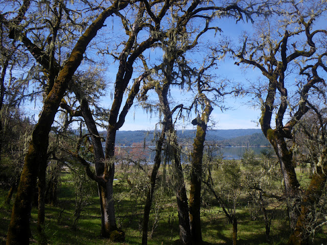
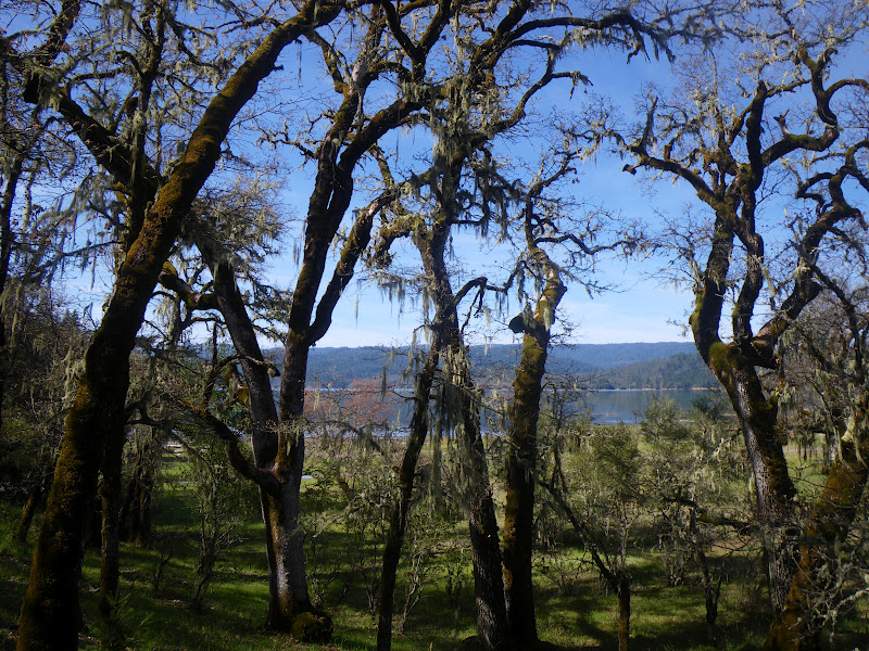
Lichen covered Oak Trees surrounding Lake Pillsbury
Van Arsdale Reservior is created by Cape Horn Dam and is the second of two dams on the Eel.  The first is Scott Dam, forming Lake Pillsury.  Both of these dams are a part of the Potter Valley Project, owned and operated by PG+E which is the second largest water diversion we will encounter on our Six Rivers Expedition behind the Trinity River.  I don't think they produce power at Lake Pillsbury and it functions primarily as a water storage for diversions to the Russian River watershed via. the 
Potter Valley Project.  

Cape Horn Dam and Van Arsdale Reservior 

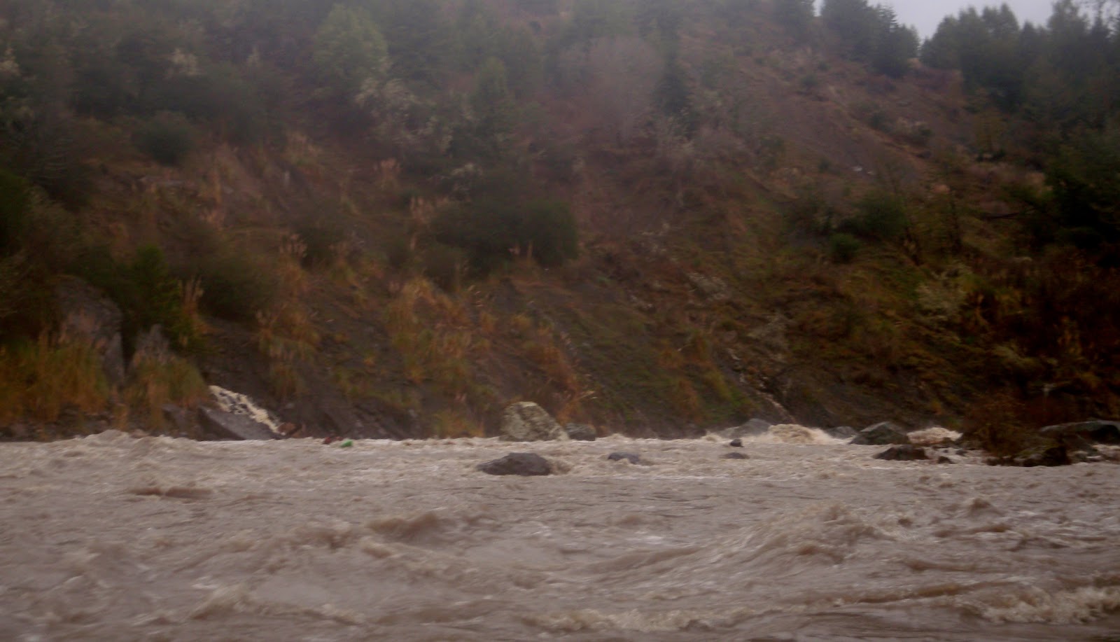
Because of the "need" to keep Lake Pillsbury full, and because of the unusually dry winter, this was only the third time this winter that a runnable flow level has passed Van Arsdale.  The last time we had checked the Eel River at Van Arsdale Gauge at put-in at 4 in the morning the river was about 1,500 cfs, although an extremely wet storm had just dropped up to 3" in some of the surrounding hills and the river quickly began to grow in volume.  By the time we arrived the flow was steadily increasing and it felt like way more than 1,500.  Turns out it was more like 3,000 cfs.


Because of the water diversions, during the summer only 5 cfs is passed down the Eel River beyond Van Arsdale.  The result is water too warm for native juvenile Salmon.  The unnaturally low flow has also resulted in many willows and alder trees growing into the riverbed.  To be honest, however, at our flow there were a couple of bad spots in the first couple miles downstream but then it cleaned up quite nicely.

 I knew this would be a factor that could potentially hamper our downstream progress--we were hoping to paddle 37 miles all the way to Dos Rios at the Middle Fork Confluence.  As such we intended to leave town early meeting up at 5:00 am to accomplish our goal.  5:00 came and I was stoked to see Victoria and Matt all bright and shiny, Paul arrived and we began gathering our equipment.  Our buddy Wes, who is always down to boat and usually on it, was nowhere to be seen.  Upon calling we discovered he was still in bed.  No problem, we all made another round of coffee and hung out watching Paul's helmet cam footy from the Milk Drop on the Lower Mad River.  Before we knew it Wes arrived with Will in tow and we were loaded and on the way.  Victoria and Wes drove for what was guaranteed to be a long shuttle and a long day.  We met up at a gas station in south Eureka for Aztec Breakfast burritos, and Matt suddenly realized he had forgotten his drysuit and had to return to Arcata for it.  No problems, such has been the way of the six rivers expedition thus far...that's why we meet at 5, right?


On our shuttle drive down to Dos Rios and back, we passed another group of floaters!  Honking our horn and waving we were stoked to see the first group of paddlers on the river since we had started out the Six Rivers Expedition.  After a beautiful, albeit long shuttle drive through Willits, up highway 20 and then through Potter Valley and over the pass to Van Arsdale we arrived at a nice and easy put-in below the almost-runnable dam.

Photo: Paul Gamache

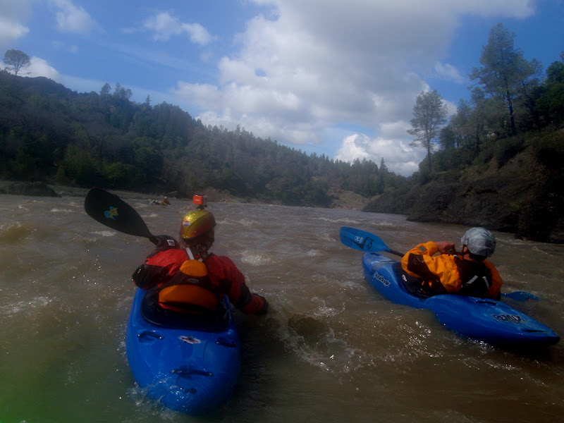
Then we were off kayaking through the willow jungles of the Eel, the water was a silty blue and the clouds were parting to make for a beautiful day.  We charged downstream and found that the addition of tributaries caused the riverbed to clean up more quickly than we anticipated.  Before we knew it we were past the willowy stuff and enjoying some quality whitewater in a roadless canyon.

Photo: Paul Gamache

The geology was interesting sandstone bedrock mixed with some peridotite looking boulders and a nice forest lined the banks dominated by oak and grey pine.  A couple of large creeks came in from the right bank, adding to our level.  I was looking forward to the Tomki Creek confluence as I have never paddled it and figured it would contribute significantly to the flow.  Tomki added perhaps another 500 cfs and the recession lines on the sandy beaches downstream indicated that we were riding at perhaps the peak of the flow spike.  Downstream the Eel continued through a nice canyon with occasional class II and III rapids.


Eventually we arrived at one such rapid with a good boof that I crashed through.  The hole seemed a little sticky and I windmilled a few strokes to get through it.  Looking upstream I got to see Paul launch into it and get stuck, clocking a solid 25 second ride or more before he freed himself from the hole.  We were all laughing at the thought of Paul swimming in a class II.  Paul's Hole marked the beginning of an awesome section of continuous class II-III that continued for almost a mile.


Making good time with the additional flow we played our way downstream with many great features and soon arrived at the beginning of the Hearst Valley.  After some brief Wiki-research, Hearst is named after the senator George Hearst, and doesn't seem to have any connection to the Hearst section of the McCloud River, though I could be wrong.  This was also formerly known as Travelers Home, and I can see why.  We were quickly floating through one of the most beautiful valley scenes I have witnessed complete with snowy mountain scenery courtesy of Sanhedrin Mountain.

Photo: Paul Gamache

Before long we were passing the bridge and entering the 18 mile Hearst section of the Eel.  I was excited to paddle this section with high hopes for a potential addition to my guidebook-in-progress.    We passed a house at the downstream end of Hearst with a whitewater kayak outside and were stoked it is a rarity in these parts.  At this point we had already covered 12 miles but still had another 25 to go. 

Photo: Paul Gamache

 No worries, though, the flows at Dos Rios were 12,000 and rising the last time we had checked so we figured our pace would continue to increase.  The Hearst section started with some fun drops and several playspots and our high spirited group continued to have a great time.  Suddenly the geology shifted to some very interesting bedrock that formed strange spires that seemed to erupt through the murky water.  It is some of the most unique and stunning scenery through which I have ever paddled and combined with the unforeseen sunny day (it was forecasted for rain and snow) the stoke level was high.
  

We passed one final property and mountainous view as we had quickly arrived to the notorious "Ramsing Corner" Rapid.  I told the crew the story about the crazy notorious landowner, Mr. Ramsing who used to yell at, and threaten to shoot, floaters who attempted to scout the rapid on his prop-er-tie along the right bank.  Right away we were giggling and decided to take a break in the sun for lunch.


The river makes a 180-degree bend around Ramsing Corner

Photo: Paul Gamache

The Six Rivers Posse, on the rocks

Photo: Paul Gamache

Its amazing all of the places this mission has taken us so far and I have no regrets for paddling any of the "flatwater" sections of the northcoast that have escaped my attention to date.  We continued downstream through an awesome section of river that constricted through monstrous boulders in an awesome class II stretch reminiscent of my childhood runs down 'Swirly Canyon' on the South Fork of the Payette River.  This was some quality river and the whole crew was in awe.


  The river was quite large and we had covered many miles at this point, knowing that the Outlet Creek confluence must be getting close.  
The abundance of play spots continued, here Paul shows you how they used to do it before cellphones.


Eventually the pace slackened somewhat and we found ourselves paddling mellow water, though some more large tributaries continued to add flow and excellent play features appeared in nearly every class II rapid.  We took another quick break and before we knew it the river was speeding up again.


Victoria with her signature smile.

Photo: Paul Gamache

Time on the Water

Photo: Paul Gamache

Then we arrived at The V-Hole, an excellent training boof that I launched through, telling the crew it was good to go...because it is.  All the boys, including myself, had to paddle hard to escape the backwash after we boofed it, because it was a sticky hole.  Then we waited for a minute because Victoria happened to be in the back of the crew for once.  We gave her the boof signal and she approached it full steam ahead.  This was really funny because merely miles upstream Victoria was quoted asking "what's the difference between a wave and a hole".  Sorry V, I guess sometimes you learn the hard way (with Paul G and his helmet cam directly next to you)


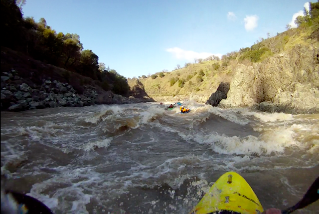
Then we came around the corner to see the Highway 162 bridge, and the aforementioned crew of paddlers taking out, it was our first real paddler sighting yet.  They turned out to be the folks with the kayak we saw, who live in Hearst and paddle the section with regularity.  After parting ways we paddled downstream to the confluence with Outlet Creek.

Photo: Paul Gamache

 Clarification, Outlet Creek drains Willits...the Outlet Creek Run is actually on the Main Eel, starting at the confluence with Outlet Creek and continuing to the Middle Fork Eel confluence.  Outlet Creek can also be paddled but is referred to as "Outlet Creek Proper".  Confused yet?  Don't blame me it's the old-schoolers fault, but if you live in Willits and say lets go paddle "Outlet tomorrow", the chances are you're referring to the Main Eel below the Outlet Creek confluence.  Reason Why?  Its awesome!

Photo: Paul Gamache

I tried to get some friends of mine to help with our shuttle attempting to bait them with "you can paddle laps of the Outlet Creek run while we do our 'mission' thing".  I kinda felt that guilt that you always feel when you ask a friend to help you with shuttle "but you could join us for your final lap", I said.  Several friends I talked to had never done this stretch and seemed generally uninterested.  I wonder what forces of the earth have caused the Eel to get such an overlooked and undesirable reputation and general disinterest.  Our crew, however, looked forward to this section as the cherry on top of our long day.  The first rapid down from the bridge continued into the sunshine and was one big = er.

Photo: Paul Gamache

Will and I, both having paddling roots in Idaho, felt right at home.  I may as well have been in Chair Creek Rapid on the Main Salmon River at 13,000 Cfs.  Then, what do you know it, there were some awesome playwaves too!

Photo: Paul Gamache

And some more great rapids led us to the dramatic Middle Fork Eel confluence where the river becomes immense.  At our triumphant take-out downstream we had checked off another 38 miles of the Eel.  While doing our shuttle a friendly local welcomed us into his home by the fire and we felt truly gifted to have experienced such a wonderful day of paddling on a river none of us had paddled or had a good idea of what to expect.  The whole run was great, the Hearst section was awesome and the Outlet Creek Run was "the best play run I've paddled in the Northcoast" --Will Parham.

Photo: Paul Gamache