Showing posts with label epic. Show all posts

Friday, March 23, 2012

Eel River Van Arsdale to Dos Rios--Six Rivers Source to Sea Expedition

The V-Hole on Vimeo

Explore Six Rivers


 In order to keep our momentum and take advantage of another wet storm the Explore Six Rivers Team decided to head south and catch a spill from Van Arsdale Reservior.  For those of you unfamiliar with the Upper Eel River, check out The Friends of the Eel River Website.  They also have a great link with info about the Potter Valley Project and its ecological effects, forming a total barrier for imperiled Salmon populations that historically spawned in the Tributaries above Lake Pillsbury.
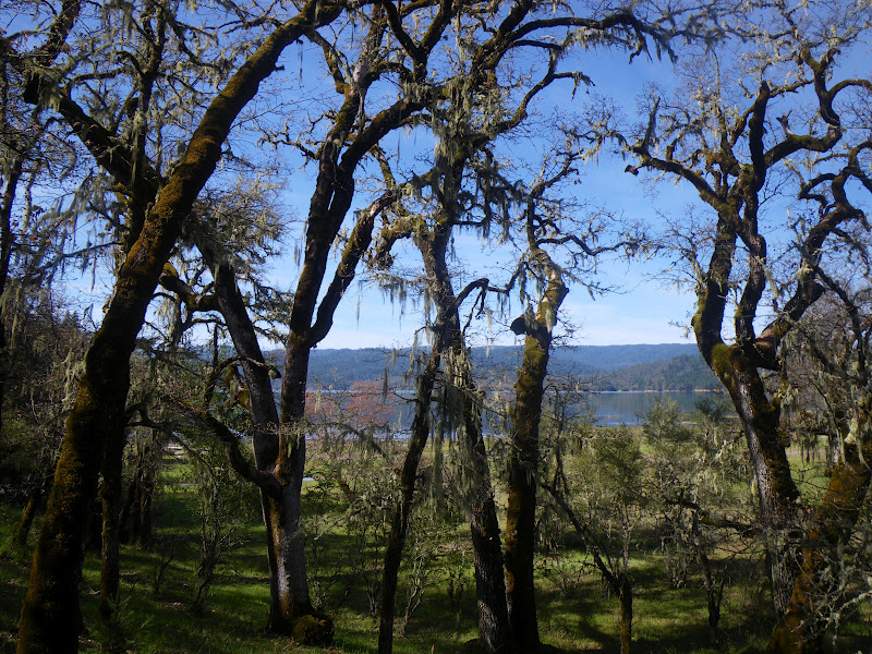
Lichen covered Oak Trees surrounding Lake Pillsbury
Van Arsdale Reservior is created by Cape Horn Dam and is the second of two dams on the Eel.  The first is Scott Dam, forming Lake Pillsury.  Both of these dams are a part of the Potter Valley Project, owned and operated by PG+E which is the second largest water diversion we will encounter on our Six Rivers Expedition behind the Trinity River.  I don't think they produce power at Lake Pillsbury and it functions primarily as a water storage for diversions to the Russian River watershed via. the 
Potter Valley Project.  

Cape Horn Dam and Van Arsdale Reservior 

Because of the "need" to keep Lake Pillsbury full, and because of the unusually dry winter, this was only the third time this winter that a runnable flow level has passed Van Arsdale.  The last time we had checked the Eel River at Van Arsdale Gauge at put-in at 4 in the morning the river was about 1,500 cfs, although an extremely wet storm had just dropped up to 3" in some of the surrounding hills and the river quickly began to grow in volume.  By the time we arrived the flow was steadily increasing and it felt like way more than 1,500.  Turns out it was more like 3,000 cfs.


Because of the water diversions, during the summer only 5 cfs is passed down the Eel River beyond Van Arsdale.  The result is water too warm for native juvenile Salmon.  The unnaturally low flow has also resulted in many willows and alder trees growing into the riverbed.  To be honest, however, at our flow there were a couple of bad spots in the first couple miles downstream but then it cleaned up quite nicely.

 I knew this would be a factor that could potentially hamper our downstream progress--we were hoping to paddle 37 miles all the way to Dos Rios at the Middle Fork Confluence.  As such we intended to leave town early meeting up at 5:00 am to accomplish our goal.  5:00 came and I was stoked to see Victoria and Matt all bright and shiny, Paul arrived and we began gathering our equipment.  Our buddy Wes, who is always down to boat and usually on it, was nowhere to be seen.  Upon calling we discovered he was still in bed.  No problem, we all made another round of coffee and hung out watching Paul's helmet cam footy from the Milk Drop on the Lower Mad River.  Before we knew it Wes arrived with Will in tow and we were loaded and on the way.  Victoria and Wes drove for what was guaranteed to be a long shuttle and a long day.  We met up at a gas station in south Eureka for Aztec Breakfast burritos, and Matt suddenly realized he had forgotten his drysuit and had to return to Arcata for it.  No problems, such has been the way of the six rivers expedition thus far...that's why we meet at 5, right?


On our shuttle drive down to Dos Rios and back, we passed another group of floaters!  Honking our horn and waving we were stoked to see the first group of paddlers on the river since we had started out the Six Rivers Expedition.  After a beautiful, albeit long shuttle drive through Willits, up highway 20 and then through Potter Valley and over the pass to Van Arsdale we arrived at a nice and easy put-in below the almost-runnable dam.

Photo: Paul Gamache

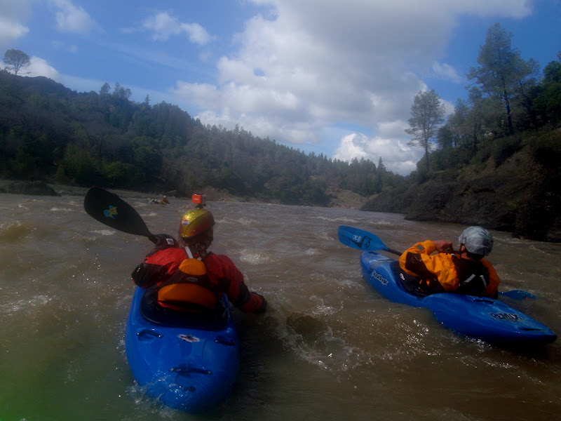
Then we were off kayaking through the willow jungles of the Eel, the water was a silty blue and the clouds were parting to make for a beautiful day.  We charged downstream and found that the addition of tributaries caused the riverbed to clean up more quickly than we anticipated.  Before we knew it we were past the willowy stuff and enjoying some quality whitewater in a roadless canyon.

Photo: Paul Gamache

The geology was interesting sandstone bedrock mixed with some peridotite looking boulders and a nice forest lined the banks dominated by oak and grey pine.  A couple of large creeks came in from the right bank, adding to our level.  I was looking forward to the Tomki Creek confluence as I have never paddled it and figured it would contribute significantly to the flow.  Tomki added perhaps another 500 cfs and the recession lines on the sandy beaches downstream indicated that we were riding at perhaps the peak of the flow spike.  Downstream the Eel continued through a nice canyon with occasional class II and III rapids.


Eventually we arrived at one such rapid with a good boof that I crashed through.  The hole seemed a little sticky and I windmilled a few strokes to get through it.  Looking upstream I got to see Paul launch into it and get stuck, clocking a solid 25 second ride or more before he freed himself from the hole.  We were all laughing at the thought of Paul swimming in a class II.  Paul's Hole marked the beginning of an awesome section of continuous class II-III that continued for almost a mile.


Making good time with the additional flow we played our way downstream with many great features and soon arrived at the beginning of the Hearst Valley.  After some brief Wiki-research, Hearst is named after the senator George Hearst, and doesn't seem to have any connection to the Hearst section of the McCloud River, though I could be wrong.  This was also formerly known as Travelers Home, and I can see why.  We were quickly floating through one of the most beautiful valley scenes I have witnessed complete with snowy mountain scenery courtesy of Sanhedrin Mountain.

Photo: Paul Gamache

Before long we were passing the bridge and entering the 18 mile Hearst section of the Eel.  I was excited to paddle this section with high hopes for a potential addition to my guidebook-in-progress.    We passed a house at the downstream end of Hearst with a whitewater kayak outside and were stoked it is a rarity in these parts.  At this point we had already covered 12 miles but still had another 25 to go. 

Photo: Paul Gamache

 No worries, though, the flows at Dos Rios were 12,000 and rising the last time we had checked so we figured our pace would continue to increase.  The Hearst section started with some fun drops and several playspots and our high spirited group continued to have a great time.  Suddenly the geology shifted to some very interesting bedrock that formed strange spires that seemed to erupt through the murky water.  It is some of the most unique and stunning scenery through which I have ever paddled and combined with the unforeseen sunny day (it was forecasted for rain and snow) the stoke level was high.
  

We passed one final property and mountainous view as we had quickly arrived to the notorious "Ramsing Corner" Rapid.  I told the crew the story about the crazy notorious landowner, Mr. Ramsing who used to yell at, and threaten to shoot, floaters who attempted to scout the rapid on his prop-er-tie along the right bank.  Right away we were giggling and decided to take a break in the sun for lunch.


The river makes a 180-degree bend around Ramsing Corner

Photo: Paul Gamache

The Six Rivers Posse, on the rocks

Photo: Paul Gamache

Its amazing all of the places this mission has taken us so far and I have no regrets for paddling any of the "flatwater" sections of the northcoast that have escaped my attention to date.  We continued downstream through an awesome section of river that constricted through monstrous boulders in an awesome class II stretch reminiscent of my childhood runs down 'Swirly Canyon' on the South Fork of the Payette River.  This was some quality river and the whole crew was in awe.


  The river was quite large and we had covered many miles at this point, knowing that the Outlet Creek confluence must be getting close.  
The abundance of play spots continued, here Paul shows you how they used to do it before cellphones.


Eventually the pace slackened somewhat and we found ourselves paddling mellow water, though some more large tributaries continued to add flow and excellent play features appeared in nearly every class II rapid.  We took another quick break and before we knew it the river was speeding up again.


Victoria with her signature smile.

Photo: Paul Gamache

Time on the Water

Photo: Paul Gamache

Then we arrived at The V-Hole, an excellent training boof that I launched through, telling the crew it was good to go...because it is.  All the boys, including myself, had to paddle hard to escape the backwash after we boofed it, because it was a sticky hole.  Then we waited for a minute because Victoria happened to be in the back of the crew for once.  We gave her the boof signal and she approached it full steam ahead.  This was really funny because merely miles upstream Victoria was quoted asking "what's the difference between a wave and a hole".  Sorry V, I guess sometimes you learn the hard way (with Paul G and his helmet cam directly next to you)


Then we came around the corner to see the Highway 162 bridge, and the aforementioned crew of paddlers taking out, it was our first real paddler sighting yet.  They turned out to be the folks with the kayak we saw, who live in Hearst and paddle the section with regularity.  After parting ways we paddled downstream to the confluence with Outlet Creek.

Photo: Paul Gamache

 Clarification, Outlet Creek drains Willits...the Outlet Creek Run is actually on the Main Eel, starting at the confluence with Outlet Creek and continuing to the Middle Fork Eel confluence.  Outlet Creek can also be paddled but is referred to as "Outlet Creek Proper".  Confused yet?  Don't blame me it's the old-schoolers fault, but if you live in Willits and say lets go paddle "Outlet tomorrow", the chances are you're referring to the Main Eel below the Outlet Creek confluence.  Reason Why?  Its awesome!

Photo: Paul Gamache

I tried to get some friends of mine to help with our shuttle attempting to bait them with "you can paddle laps of the Outlet Creek run while we do our 'mission' thing".  I kinda felt that guilt that you always feel when you ask a friend to help you with shuttle "but you could join us for your final lap", I said.  Several friends I talked to had never done this stretch and seemed generally uninterested.  I wonder what forces of the earth have caused the Eel to get such an overlooked and undesirable reputation and general disinterest.  Our crew, however, looked forward to this section as the cherry on top of our long day.  The first rapid down from the bridge continued into the sunshine and was one big = er.

Photo: Paul Gamache

Will and I, both having paddling roots in Idaho, felt right at home.  I may as well have been in Chair Creek Rapid on the Main Salmon River at 13,000 Cfs.  Then, what do you know it, there were some awesome playwaves too!

Photo: Paul Gamache

And some more great rapids led us to the dramatic Middle Fork Eel confluence where the river becomes immense.  At our triumphant take-out downstream we had checked off another 38 miles of the Eel.  While doing our shuttle a friendly local welcomed us into his home by the fire and we felt truly gifted to have experienced such a wonderful day of paddling on a river none of us had paddled or had a good idea of what to expect.  The whole run was great, the Hearst section was awesome and the Outlet Creek Run was "the best play run I've paddled in the Northcoast" --Will Parham.

Photo: Paul Gamache

Sunday, March 18, 2012

Lower Van Duzen River--Grizzly Creek to Fortuna


This leg of the Journey was unique in that it combined a section of river with which we are very familiar, The Grizzly Creek Run, with the Lower Van Duzen just downstream.  After another much-needed storm the Duzen was flowing at 8,000 cfs at Bridgeville and we looked forward to some big water play and easy miles to the confluence.  A low fog hung in the river canyon and it was drizzling when we put back on the Van Duzen River at Golden Gate bridge, the take-out for the Goat Rock section. 

 Immediately we were surfing waves and playing our way down class II rapids towards Grizzly Creek.  We stopped at the Grizzly Creek mouth to get some shots of the beautiful old-growth forest and the clouds parted to make for an unexpected bluebird day!


The Grizzly Creek section is classic 2 mile play run that can be a snaky class III rock garden at low water, or a class IV huge-water extravaganza after big storms.  The playboating on this section of river is fantastic and I usually paddle the whole section facing upstream, trying to catch any and all waves.  After the Willow Hole and a good playwave, you round Devil's Elbow and the real fun begins...its basically a 2 mile long rapid full of exploding waves and holes.  The river reaches a head at the Corner rapid, where a solid rapid drops around the corner with a big cliff along the right bank and landslide on the left.  Downstream from here a couple of smaller rapids remain before reaching our normal take-out at the low-water bridge site.  Here Wes exits the Corner Rapid.


Rant: At this point I would like to genuinely thank Paul Gamache, for giving me a reason to paddle all of these rivers in their entirety.  I have driven to and paddled the Grizzly Creek section close to 30 times, every time we usually do a couple of laps to make up for the short distance of the run.  Not once, however, did I think about paddling downstream from here.  Nobody ever talked about it and we pretty much assumed it was uninteresting flatwater.  Nothing could be further from the truth.  Even to a youngbuck kayaker chasing the whitewater dream, rivers have more intrinsic value than simply their whitewater alone!  The major discovery of mine is that the Lower Van Duzen has some of the most amazing redwood scenery I've ever seen after 12 years of living on the coast.  There is no better way to see these trees than from the river, where the open canyon allows full views of the trees from trunk to top.  We stopped to take a break and walk through the forest at Owen Cheatham Grove.


The towering trees stand so majestically and create a unique quiet, you can hear the crunch of the soft needles beneath your feet as you walk around.  Occasionally a bird would chirp but the Redwoods literally are like a vacuum of sound.  The light was beaming through the trees creating beautiful shadows and I was stoked to be exploring a new grove of trees.  It turned out this was a filming location from Star Wars Return of the Jedi, but no Eewoks were seen.  It was a little squatchy though.


Paul realized he had left the keys to our shuttle rig at put-in and he and Wes took off to go get them.  They were picked up by the fourth car that passed, as I firmly stand by Highway 36 as the best hitchiking road I know of.  I was happy to have an excuse to hang out in the redwoods for a while longer, and so was Will who took advantage of the opportunity to get some beautiful shots.  After our extended break, we continued on downstream to more amazing scenery.


I don't know which particular Grove of Redwoods these are, but they are Magnificent!  Can't complain about the weather.


Impressive Sandstone bluffs along the Van Duzen River 


I always love being able to paddle into overhanging spots like these. 


There is no other way to describe the scenery but amazing.  When the river passes beneath huge sandstone bluffs with enormous old growth trees it makes you feel very small.  I was feeling a natural high from the en-dwarf-ines.


And suddenly the Van Duzen scenery opens up as you have left the Redwoods behind in the Van Duzen's final push toward the Eel.  The Van Duzen enters its wide floodplain with braided channels, landslides and wood hazards.  It starts to smell like cattle, as Dairy is a major livelihood in the area.


Confluence of Yager Creek downstream of Carlotta 


The finish line of sorts, Highway 101 bridge just before the Van Duzen meets the Eel.


 Paddling both the Grizzly Creek section and the lower section below it are highly recommended although I wouldn't continue past the Strong's Station area next time since the scenery drops off and there are no more good access points until the Eel.  We had lots of water and the float went very quickly, at lower water I'd expect more pools and a much longer float time.  Occasionally the river flowed towards some dangerous wood hazards, though they were mostly easily spotted and avoidable.  The abundant flows were nice and I wouldn't personally return with less than 1,000 cfs.  During the summer, however, many of these pools make for excellent swimming and the water becomes warm and clear.
On to the next river!

Monday, March 5, 2012

Van Duzen River--The Bloody Run Day Two


Check it out, Explore Six Rivers Source to Sea
If you haven't read it here is the Day one description
 Here is Paul's Helmet Cam Footage of the Bloody Run

Photo: Wes Shrecongost

We slowly woke up on the second day to a cold heavy frost.  After staying in our sleeping bags to retain warmth the sunlight peeked up over the hillside and its strong rays coaxed us from our cozy confines to  get ourselves fed.  Knowing it would be another full day on the water we optimistically hoped that at some point the river character would change and open up into more runnable rapids.

Photo: Wes Shrecongost
The river level had dropped only slightly overnight and after we packed our boats and pumped drinking water we were ready to go by nine o clock. 


Downstream from camp we were treated to an easy section of water with beautiful Van Duzen scenery before more congested boulder gardens reappeared and it was back to the portaging routine.

Photo: Wes Shrecongost

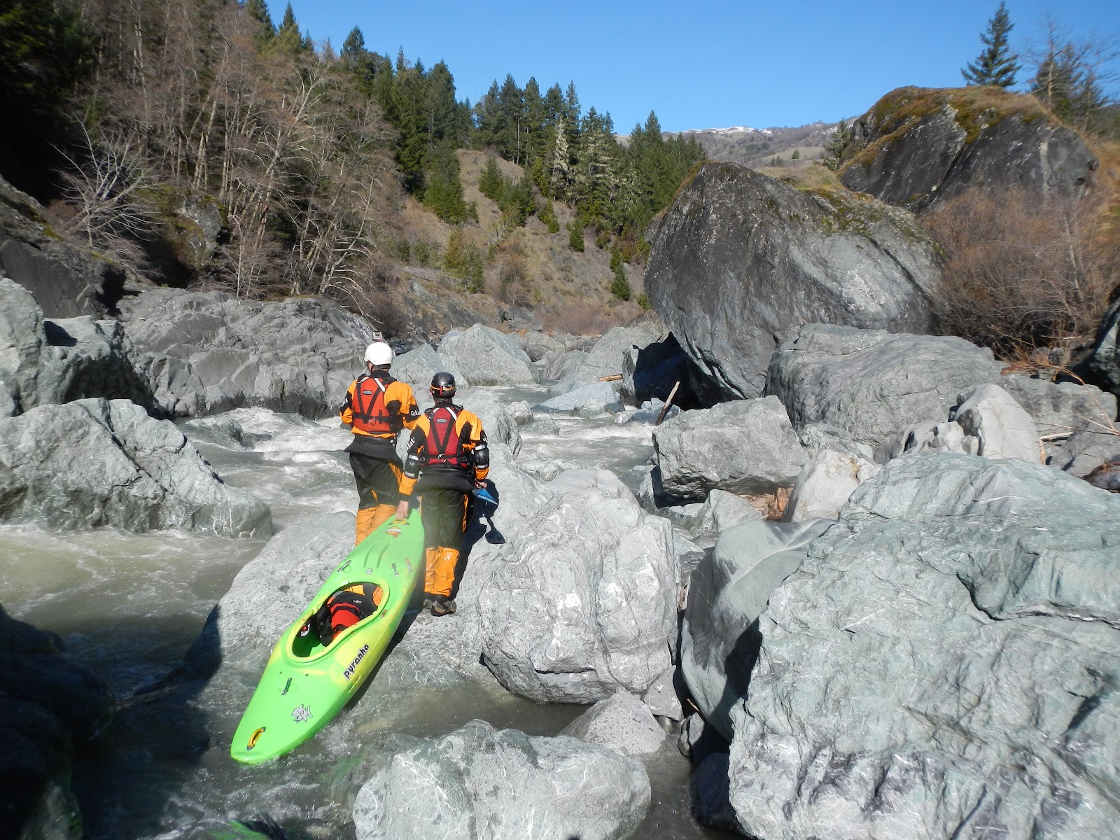
The river seemed to be changing for the better, as we found good lines through more rapids than the previous day.  Our runnable rapid to portage ratio began to balance out closer to 50:50 and we enjoyed some of the best rapids of the run.


This still meant dealing with many large boulder gardens that made for exhaustive portaging, not to mention we were all shagged out from the previous day’s efforts.  Get back up to the hillside...yeehaaaawww!


Now go through that poison oak bush...you know you like it!

Photo: Paul Gamache

Finally we reached an extended calm period of water and began to get our hopes up that we had passed the meat of the run. 

Photo: Wes Shrecongost
We now refer to this as the Glimmer of Hope, because shortly downstream the river slid into yet another boulder gauntlet.  Checking our GPS we realized how many more miles lay ahead and started to push harder in hopes of keeping our trip to a 2-day.  

Photo: Paul Gamache
The canyon began to open up with beautiful scenery characterized by enormous chunks of rock.  At this point we also were starting to Bonk. 

Photo: Paul Gamache
Hmmmm...big seal launch into murky brown water of unknown depth or climb around on some giant boulders with a heavy loaded kayak for the hundredth time?

Photo: Paul Gamache
Fortunately for me and Wes, the murky brown water was deep and unobstructed.


Just downstream another fun rapid pinched before pushing into an undercut that couldn't be seen from above.  Wes probes it out.


After a couple more miles of better rapids, the gradient was gradually dropping and we started covering miles without making a portage.  There were some interesting rapids thrown into the mix too.


Wes attempting to spot his line through another boulder jumble

Photo: Paul Gamache
Finally, we passed the namesake drainage, Bloody Run.  This creek comes in from river left and marked the end of the high gradient sections.  It also appears to have remarkably high water quality considering the brown nature of many other smaller side-streams.

Photo: Paul Gamache
One more tricky portage remained downstream before the Van Duzen flattens out for the remaining miles to Bridgeville.

Photo: Paul Gamache


  We passed one massive landslide in here that looked like the entire hillside was basically flowing into the river and it turned out being the final portage of our trip!  We relaxed and paddled the flatwater through beautiful scenery the rest of the way.

Photo: Paul Gamache
Eventually we arrived at the confluence with Little Larabee Creek and Highway 36.  After some celebratory high-fives, Wes made his way up to the road where the very first vehicle driving by picked him up. 

The Bloody Run is an adventure that I hope to repeat someday.  I feel like our mission opened up a run that may become a “cult classic” along with the Grand Canyon of the Mad River, just over the hills.  Several times we found ourselves portaging on the wrong side or around sections we could have committed to had we known there were lines.  With slightly higher water levels many possible routes would open up although many of our portaging options would be limited too since they were at river-level.  I know the write-up description makes it sound like all we did was portage, however looking back at Paul’s helmet cam footage we were also able to run many quality rapids as well.  Best of all, by starting out our Six Rivers Source to Sea Mission with a banging first descent, we gathered the momentum and confidence we needed to keep the ball rolling!


Major points from the trip:
If we had more time we could’ve run more rapids

The Little Van Duzen is a better put-in than Highway 36 to avoid a massive portage near Dinsmore and include another great section of river.

Information about the previous trip got twisted by each successive storyteller, to the point where it was virtually useless.

Exhausting nature of portaging/scouting- The never-ending onslaught of mind-bending boulder gardens takes a toll on your mental awareness and ability to maintain focus.  

Miles were extremely hard for us to cover.  Every time it seemed that we were going into a more runnable stretch of river we found a difficult portage or scout instead.  At one point we were making 1/2 mile an hour.

Difficult decision-making: to portage over this boulder or around that one, to portage up to a grassy hillside or stay at river level.  The river disappears into a boulder garden where 4 of the 5 slots are sieved-out and it becomes difficult communicating lines back to the crew through this complex of rapids.

Importance of bringing overnight gear: although it made our portages much more difficult and extra effort, the gear became worth its weight in gold once it became clear that we wouldn’t be making it out in a single-day. 


Importance of having a map, or GPS to locate yourself and realize how much farther you have to go.

Importance of picking a good campsite, one with flat spots and wood to burn, at the right time of day before it gets too dark to set-up camp.

Sometimes you just have to put your head down and start charging through the poison oak, otherwise it would be impossible to accomplish this river.  However I am happy to report that three weeks later I have no signs of the P.O.!  


The importance of a good crew cannot be stressed enough, we all proceeded safely and patiently which contributed to our safe return.


Going on adventures, even those which require lots of portaging, are still always worthwhile for the sense of accomplishment and change of perception they can provide.