Thursday, February 17, 2011

Upper Hayfork Creek

A Short Video of Upper Hayfork Creek...I.K. Carnage? Yes.

Upper Hayfork is an interesting run that is shrouded in a cloud of mystery.  When I first read the Stanley/Holbek description, it turned me off to the run.  All the talk of portages and fishladders on a class III-IV+ section just didn't sound too appealing.  The grossly inaccurate flow information provided in the book only served to perpetuate the less than appeal for Upper Hayfork.  It's true that the Dam is managed differently on the Trinity these days, but even in the 80's, 3,000 cfs on the Trinity @ Hoopa did not translate into 500 cfs on Upper Hayfork Creek.

The Wolf
To make a short story longer, I was talking with my buddy Alex Wolfgram one day.  I mentioned Upper Hayfork, and in his charismatic fashion "Duuuuude!  That run is awesome!" Alex proceeded to explain that the "portages" were actually the best rapids on the run.  Then, Upper Hayfork made my list.


Upper Hayfork Country is just that, country.  Some very cool limestone outcroppings along the drive definitely peaked our interest though, as well marked signs for a natural bridge out here.  We set shuttle, and took off driving upstream from the East Fork of Hayfork Confluence at an obvious bridge.  Less than a mile upstream, the Fishladder is visible from the road, in a beautiful bedrock gorge...I wiped my eyes, "was this for real"?  In my typical fashion I tried not to let my expectations get too high for fear of letdown.

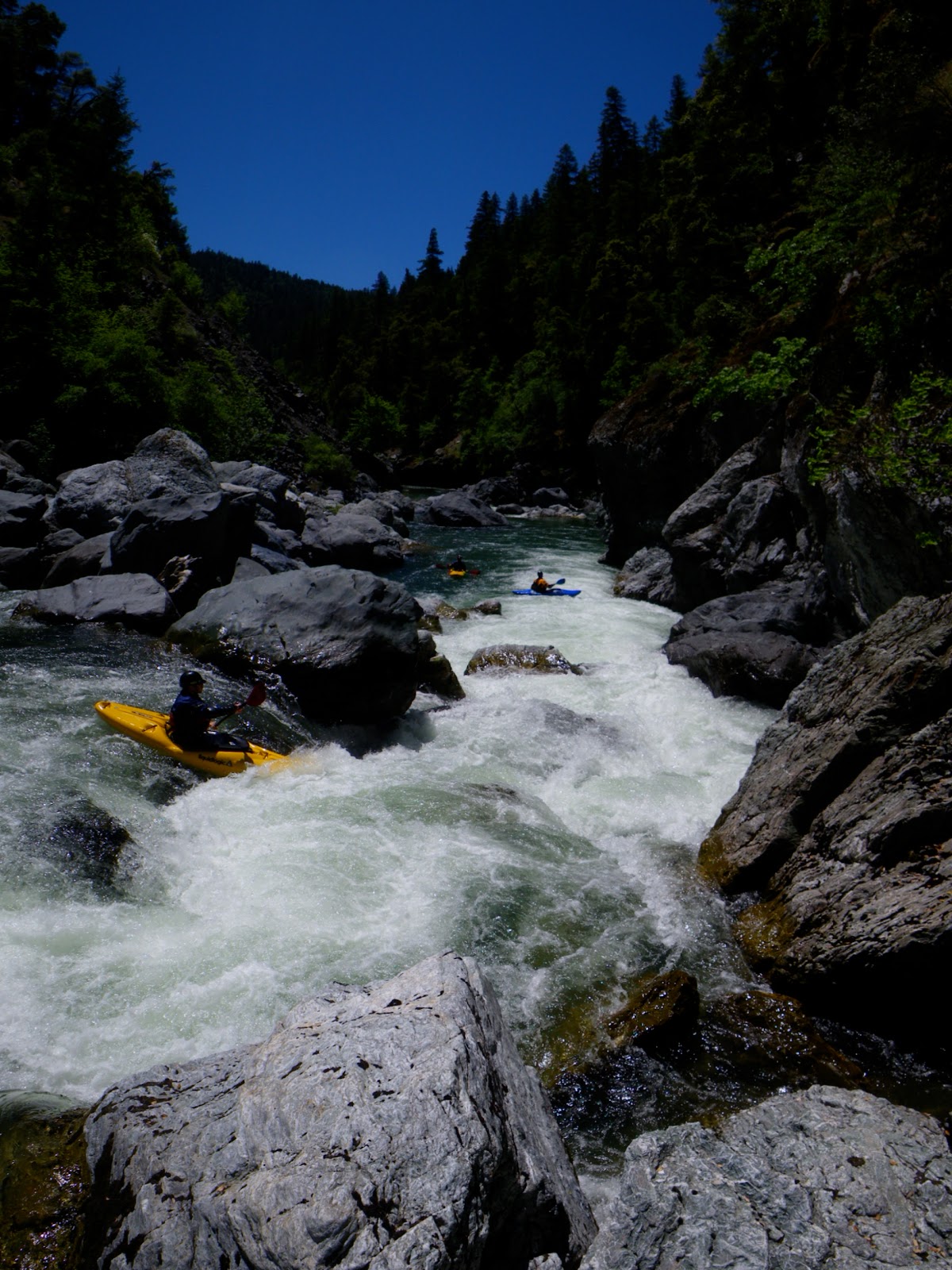
The put-in is a cherry little spot where you can park about 10 steps from the creek.  We waved goodbye to our Inflatable Kayaker Shuttle Driver who elected not to paddle the run with us due to time crunch.  Due to the time crunch, I didn't get many pictures either, but here they are, blurry ones and all.  Damon bounces through Roxy's Rock


The run continues along with good gradient and lots of bedrock.  Eventually you reach the obvious gorge portage.  The eddy above this is rumored to be extremely difficult to catch at certain flows, but with our scratchy level was no problem.  This gorged in rapid is literally so boxed in that its difficult to get a really good scout at it.  I basically traversed the entire portage route along the left gorge wall and was unable to get a good look.  Be careful if you portage as it is a little exposed up there.  
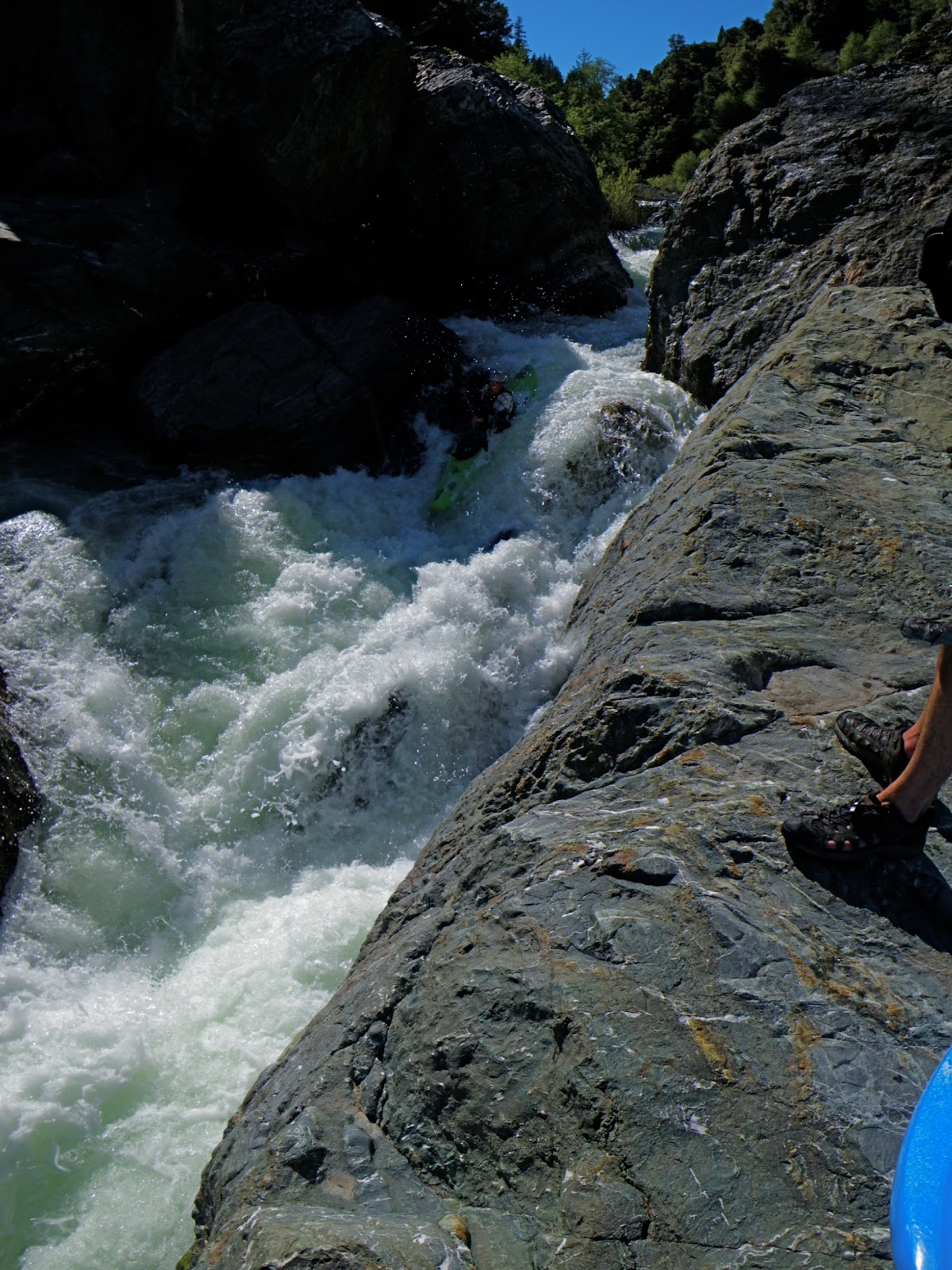
The rapid is a split drop around a rock that would make for juicy hydraulics if you came at it with high water.  There is also nowhere to set safety from, so even though its not a bad drop, treat it with respect.  Looking down the left slot.


I was able to climb up onto the gorge wall and take this shot.  You can't see the entrance rapid from this angle, but there is one.  At our flow we ran the left slot because the river right was too tight.  At higher water I bet the river right channel would make a sweet boof and be the preferred line.


Downstream was one more extremely tight boulder slot that could've used more water.  We did a boof to gorilla to seal launch maneuver, as always: scout when in doubt.  After this first gorge, the creek opened up again until we arrived at this sweet drop.  Well, it kinda landed on a rock shelf, but as long as you stick your boof it's good to go.  Damon Goodman sticks his signature Goodboof.


   More fun rapids downstream that could've used more water to make them more fun.


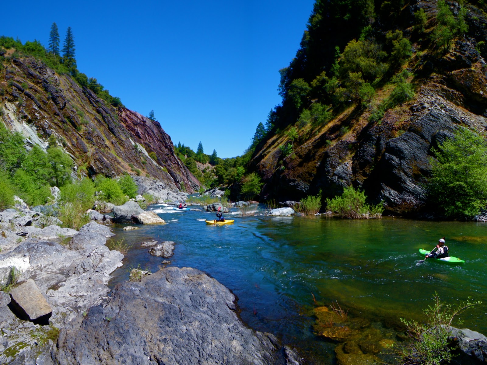
The view downstream


Finally, we arrived at Fishladder Falls.  And who was waiting for us, but our I.K. buddy Aaron, all suited up and fired up!  We were stoked!  Rumor has it that this drop actually used to be a falls, but it was blasted to allow for fish passage.  I can only imagine how sweet of a drop this used to be, but hey it's still sweet.  When scouting this drop, I didn't notice any chucks of rebar, but you know its in there, so be careful.  Here is the sweet entrance boof preceding the fishladder.


Aaron watched Damon and I grease the line, and with the look in his eye, jumped into the I.K.


Aaron charged through the first two holes, the third one he got sideways and was fine, but when he turned around backwards in the fourth drop, the boat was completely full of water.  Fishbone then performed a backwards piton, shedding the water and him from the rocketing I.K.  He then performed the inverted running man maneuver with true grace, as he swam the run out to the drop.

The take-out is less than a mile downstream, where you can also park within steps of the creek, just a little ways upstream from the bridge another small road goes right to the water.

Final Notes:
1) We paddled this one last spring as an after work run from Weaverville, though we did cut out of work a little early that day(3ish).
2) The flow was 1,600 cfs. at Hyampom, and though it was enough water to get down the run, I personally would prefer 2,000+ to juice up the hydraulics and pad things out.  I realize this is just my personal preference, and somebody else may find it enjoyable with lower flows, it was definitely not a stressful run.
3) I think the 3rd portage in the Holbek/Stanley book is the panoramic shot, but it could've been the one where Damon is bouncing over the rock.  We may never know.
4) The Fishladder drop is truly park n huckable, with an easy trail leading back to the top, and was actually really good at the lower level because its so channelized.  Next time I'm there and its a little bony, I'll just run the fishladder a few times and call it good...it was the best drop anyway.
5) This run belongs on the top list of Bike shuttles.
6) When this creek is flowing good I bet its a real kick in the pants the whole way.

Friday, February 11, 2011

Upper Middle Fork Eel River: Day Two


Day Two:

We camped at Hammerhorn Lake again, chowing down on food and going to bed early.  The plan was to have a crew run shuttle, whilst a couple of people stayed behind at camp to cook breakfast burritos and to make burritos for the river trip.  The shuttle is incredibly long, so after nearly two hours, we returned to camp and hurried our breakfast along.  Minutes later, the crew was tracking our way back down into the canyon, arriving at our boats close to 10:30.  Mike had come down with a cold and elected to carry his boat back to the road.  We were all bummed to be losing a member of the crew, but given his condition he made the right decision.  As we would later learn from Warner, it was a nasty cold indeed!  Here is Ed running the second breakfast rapid.


Here is the view Downstream


Immediately we dropped into a great section of continuous rapids with more water than the previous day.  The first two miles of the day would drop 125 and 215 feet respectively so we were expecting lots of action.  As on day one, we were able to boat scout 90% of the rapids that turned out to be cleaner and more fun as we went.  Unfortunately, John boat-scouted a drop blind, landing on a sharp rooster tail-rock that cracked his boat under the seat.  Investigating the crack.


With a foam patch cut from his pillar wedged between the crack and seat, we charged onward through more fun drops.


It seemed that we had a near perfect flow.


Another Rapid I scouted with a nasty piton rock, the crew wasn't convinced with my suggested line after Warner had a near brush with the rock here.


We had gone less than two miles and already we were stoked on the pace of the run.

A Bummed Warner

But the crack in Warner's boat had gotten worse. He was able to continue to the end of the second mile, at Beaver Creek.  It was here that John wisely elected to hike out, the river was still close to the road, and 10 more miles remained with another steep section through the "Osbourne Roughs" that dropped 111 and 242 feet in one two-mile stretch.  We made sure he drank lots of water, because it was getting damn hot.  His hike out is a different story though, as our crew of 5 became 3.


Onward we charged as two miles of relaxed whitewater with several spicy drops peppered in brought us to the confluence of Howard Creek, the beginning of the steepest gradient.  It was here that we took a lunch break, mowing down burritos and hydrating with an abundance of water.  


The weather was 90 degrees, helping snowmelt to hold the river flow.  Numerous tributary accretions had swollen the river to a healthy 800 cfs by this point, making for some powerful hydraulics and interesting seams.  Despite our expectations of deathtraps and a menacing character however, the run remained incredibly fun and beautiful.


            After lunch, the river's gradient slowly began to increase again.  A little slow on the trigger finger 


Eventually we reached the Osbourne Roughs, a steep and continuous boulder garden section very reminiscent of the final 9 of the Middle Kings, or Golden Gate on the South Fork of the American.


  The difference was the type of rock, as there was absolutely no granite to be seen.  Instead, we encountered house-sized boulders of Chert, Schist, Gneiss, and Mudstones intermingled with the predominant sandstone bedrock on river left.  Orion charging towards the steepest part of the run


Orion, charges on Downstream


Ed in the next boulder garden


There were nasty hazards to be avoided but fun boulder garden rapids continued one after another until we reached the crux of the gorge: Steelhead Falls.  


We were officially in the crux of the run, and our healthy flows translated into meaty hydraulics.  Though we portaged twice in here, they are both the kind of rapids you want to go back for.


As we scouted this enormous drop, Steelhead were jumping up the various channels, smacking into rock and sometimes making it over the falls.

  
At this point the significance of paddling on the Middle Eel occurred to me, not only were we experiencing a true adventure, but life in its fullest.  A healthy salmon stream is not widely encountered while paddling these days, in many ways our journey reflects the travels of these fish, bumping our heads into rock over and over before we get a chance to spawn.  The portage was mellow on the left, and downstream another huge, yet runnable rapid was portaged left as well.


The view downstream


Ed and Orion charging onward.


Some truly beautiful whitewater in here


We didn't walk too many times.  Orion launches another sweet boof.

And Sticks It...


And suddenly, the Middle Eel hits flatwater, the perfect time for a break in the shade. 


Time to relax 


After rounding a corner and charging through a sweet rapid, I recognized it as the one visible from the Recon section weeks before.  The final gorge of familiar whitewater went quickly, arriving at the Black Butte Confluence at 5:00 pm after another long day on the water.  Miguel was waiting for us at take-out, but Warner was not, so we proceeded to drive back up the road for our lost buddy.  We found him, riding in the back of a jeep with two friendly ladies, having a great time.  

Driving back for Warner's boat
            The Middle Fork exceeded all of our expectations and is a classic stretch of California whitewater that deserves to be on any class IV-V paddler’s list.  The amazingly forgiving river, quality whitewater and spectacular scenery and solitude make for one of the best rivers I’ve ever paddled.  Friendly locals greeted us as we arrived at the take-out, as well as a giant rattlesnake.


 Rattlesnakes inhabit the area, so I brought a snake-kit before our trip.  Some of the unique rocks were slippery (soapstone) while others were incredibly sharp, so good footwear is highly recommended.  Sunscreen and a water filter were nice too.  Additionally, the Black Butte River Ranch Store will run shuttles for both sections of the Middle Eel if you arrange it with them, phone # (707) 983-9438.  They also have Yolla-Bolly wilderness maps and cold beers at take-out (or put-in).  The Forest Service office was helpful in assisting us with access information as well, the Covelo Ranger Station # is (707) 983-6110.  We had flows around 1,600 at Dos Rios.  Go out and enjoy some wilderness paddling in one of the most remote areas of California and the West Coast.

Tuesday, January 18, 2011

Upper Middle Fork Eel River: Day One

On May 2nd, 1993 a group of kayakers attempted a first descent on the upper Middle Fork that flows from the Yolla-Bolly wilderness.  This trip resulted in the fatality of early Czech paddling phenomenon, Jaroslav Mach, forcing abandonment of the trip and generating a bad reputation for the river.  There is literally no information regarding this 22-mile stretch of river or of the attempted first descent, merely a tragic legend from Lars Holbek’s NFMF Feather River Description on page 128 of The Best Whitewater in California.  After one of the wettest Northern California springs on record, we decided it was time to revisit the Upper Middle Eel.


History: Round Valley Reservation
The drive to the Middle Eel takes you through the beautiful Round Valley.  Round Valley is culturally and geologically unique.  The original inhabitants of the area were the Yuki tribe who established themselves thousands of years ago.  The Yuki lived in this harmonious setting for millennia until the arrival of white, gold-seeking settlers in 1854.  Conflicts escalated in 1856, and the entire Middle Eel Watershed was designated “Nome Cult Reservation”.  This was probably due to its remote setting and a lack of gold-bearing rocks, but officially to ‘protect’ local tribes.  By 1864 however, the reservation was reduced to 1/5 its original size and became known as the Round Valley Indian Reservation.

 
Round Valley

Because the land was considered to be of little use to the white man, other Native American Tribes were displaced from all around Northern California and forced to relocate here.  This includes the Nomlacki, Wylaki, Lassik, Sinkyone, Pomo (Including Cahto, Kabeyo, Shodakai, Yokayo, Shokawa, Shanel, Kashaya, and Habenapo among others), Wappo, Concow Maidu, Colusa, and Achumawi.  These tribes were relocated here prior to reducing the reservation size.  The Nome Cult Trail was named after 461 Native Americans from these various tribes were forced to march a veritable “trail of tears” guarded by soldiers.  Leaving from Chico on September 4, 1863 they marched across the central valley and over Mendocino Pass, reaching the Eel River Camp (the Black Butte River Confluence) on September 17.  The trip resulted in 32 deaths, a few escapees, and 150 natives who were left behind since they were too sick to continue.  Men, women and children were all forced to make this 100-mile march to the Nome Cult Reservation that finished a day later.  Following these events, the Round Valley Reservation remained relatively unaffected for nearly a century, until water politics forced the re-appearance of government bureaucrats and legislation.

Geology: Yolla-Bolly Mountains:
The Northern Yolla-Bolly Range marks the southern terminus of the Klamath Mountains geologic sub-province.  The higher peaks are volcanic with abundant granitic and basaltic formations.  However, the southern extent of the range through which the M.F. Eel flows contains almost entirely coastal-origin metamorphic and sedimentary rocks.  This river has some of the most unique rocks I have ever seen, from gorge walls lined with red and green chert to sandstone bedrock and enormous calcite boulders.  In fact, the most similar scenery lies along the coast.  Though we expected menacing undercuts, man-eating sieves and gorged-out mandatory rapids, the river turned out to be amazingly clean and runnable.  Passing through a sandstone bedrock gorge on one side, with a grassy hillside on the other is an amazing and beautiful experience.  Nearly all of these grassy slopes are evidence of active earth flows, rather than past logging practices.

Orion Portages Asa Bean

This river is prone to massive high-water events, clearing the channel of any wood hazards at our flow.  This also results in unstable rapids that may be likely to change annually.  During the unprecedented flood of December 22, 1964, the estimated discharge of the Middle Eel at Dos Rios was 270,000 cfs.  This major event caused massive changes throughout the watershed, resulting in what the early paddling community described as a drastic change, namely “all the intermediate and advanced runs on the Eel became easier by about 1 class.”  This resulted from massive deposition of sand and gravel into the river channel, produced from countless landslides due to clear-cutting.  In fact, studies have shown that the average depth of pools in the Eel River watershed has decreased, reducing the abundant cold-water refuge that native Summer Steelhead and Spring Chinook Salmon require.  Not to mention that fish numbers in the Eel River drainage and entire Northern California have dropped as well.

Recon Run:
On May 22, I picked up my friend John Warner and headed south to check out the Middle Eel, flowing 2,000 cfs. @ Dos Rios.  We made the long haul through Laytonville, Covelo, and beyond the Black Butte River confluence to where it leaves the highway.  Much to our dismay, 7 miles up the road we were stopped by a locked gate.  After making the journey however, we were committed to getting on the water.  On our drive back we found a forest service road that descended towards the river, and we followed it to the end.  This put us at a beautiful campsite above the final class III-IV gorge 4.5 miles above the Black Butte.  We were able to descend a delightful grassy hillside all the way to the river (1 mile hike) for an easy-access run with a bike shuttle to boot.  This only whetted our thirst for more adventure in the drainage.  On our way out, John asked the Ranger when the gate would be open, and he informed us it was supposed to be open, but the fire crew had unnecessarily locked it.

Looking upriver near Black Butte confluence

Upper Goods: Day One
Two weeks passed, and we returned with a solid posse of five.  Mike Lee, Orion Meredith, John Warner, Silent Ed and myself made the haul beyond Covelo to get the goods.  The flow was 1,650 and fluctuating daily due to snowmelt so I called the Forest Service office to check on road access and was told that the road to Indian Dick was open.  This would allow us to reach the headwaters of the Middle Eel above its confluence with the North Fork of the Middle Fork (NFMF).  The logistical plan was to break the run up into two sections, hiking out at Pothole Crossing where the road comes close to the river.  This would grant us the ritual paddle without loaded kayaks, as we were anticipating lots of portaging. 

We made the long drive, eventually camping at Hammerhorn Lake.  That first night the Scorpion King visited Orion; the local wildlife was advising us to be on guard.  The crew got an early start, setting shuttle and arriving at Lucky Lake close to 8:30.  This put us on the trail by 9, although we didn’t reach the river and put on until 11.  We were excited for the reasonably early start as the ten-mile stretch averaged 105 feet per mile.  This section required a 3-mile hike down a road and decent trail, although we did note that the game trails are much more heavily travelled.

Miguel Hiking into MF Eel River Drainage flowing right to left
 
Silent Ed at Put-in

            The first mile of paddling to the NFMF was small and creeky; approximately 150 cfs carried us through class III-IV boulder gardens, culminating in a solid class IV canyon above the confluence.  Due to the extremely warm day, Ed decided he was going to skip the drysuit and go skin to wind...this didn't last long and shortly after the NFMF we stopped so he could don his drysuit.


The additional flow at the confluence immediately opens up the riverbed, and after an easy mile of scenic water, we started dropping through continuous class IV boulder gardens.


Then it was time for a little nap


  The canyon was incredibly open, and the river occasionally flowed around the base of enormous rock walls, despite an open grassy hillside along the other bank. 


After several fun miles of water and significant tributaries to add flow we arrived at Asa Bean Crossing.


   I recognized it immediately from a picture in the Wilderness Map and marveled at the stunning stretch of river that dropped through enormous sieves and house-sized boulders.  We portaged through a field of waist-high grass sans-ticks reminiscent of an Austrian landscape.  The ground was incredibly unstable, with cracks, fissures and slumps hidden amongst the grass.  Lucky for us it wasn’t totally moist shoe-robbing goo.  

Silent Ed lets his paddling speak for itself

John Warner cleans the next drop

Ed and John paddled the run-out from the portage that contained several large drops.  Below here more fun rapids continue, as the gradient mellows and the river flows through some gorges of red and green chert.  


Fun Sandstone Bedrock in this section

Eventually you reach a major pinched out class V drop that Ed and John paddled, until the gradient relaxed for a couple miles.  

Warner styles the Pinch

By the time we reached Pothole Crossing it had been a long day on the water.  The hike back to the road wasn’t too difficult, as we were able to follow game trails, and happy not to be carrying our kayaks.

Orion reflects on a good day of boatin' 

Sorry I didn't get this out sooner.