Saturday, November 27, 2010

Return to Hardscrabble

Well, I guess its already a new paddling season.  That summer sure was a short one, and the water seemed to just keep on flowing.  After a brief 5" rainstorm this October, we were blessed with the opportunity to get on Hardscrabble Creek.  This run is extremely difficult to hit at a good level, which is basically, high.  You need a lot of water on the Smith to make this run go.  I recommend 15,000-20,000 at a minimum, and if its dropping quick you may already be out of luck.  The best way to gauge it is visually inspecting the take-out and hoping all the rocks are covered.  It it looks bouncy or scratchy, go elsewhere...that being said, we arrived and it seemed a little bony.  But we were jonesing to go creeking, and it had been raining hard so the hope was for rising levels.  During the shuttle drive to put-in, we encountered monsoon-like conditions, which brightened the mood.

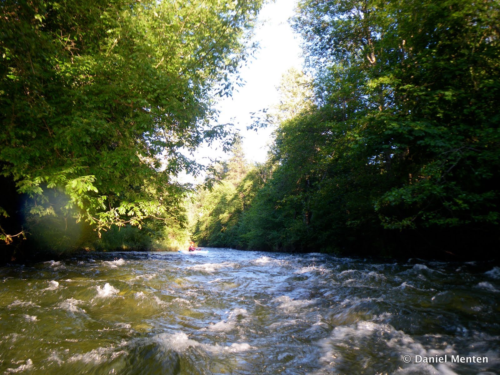
  Once on the water, you will be scraping over many sharp rocks in a tiny creek.  Eventually you reach another tributary, and then another, until it suddenly seems like a reasonable flow.  Where the canyon necks in, and a road is visible on the left, get out to scout the first gorge.  By walking down the road on river left you get this view of the steepest part of Hardscrabble Creek.  We were stoked because the flows seemed to be coming up after that downpour on our shuttle drive.


Downstream, another large tributary comes in, and the creek backs off for a little while.  Damon Goodman and Craig Hull enjoying the October creeking.


Eventually you reach a long and steep boulder garden rapid where the canyon opens up.  This is followed by a calm pool and horizon line signaling this drop.  Chris Zawacki boofs on an earlier trip.


Then it backs off again, for a little while.  As the gradient steepens up again, be prepared to portage Judo-Log Roll, one of the sketchiest logs I've ever seen.  This rapid is named after Alex Wolfgram escaped a sketchy situation, where he was splayed over the log with his leg trapped in his boat which was underneath the log.  Be extra careful to scout this one because the log isn't easy to spot...making it extra dangerous.  Here is a shot of the rapid preceding Judo-Log Roll, in the foreground is the entrance.


Damon Goodman looking at Judo-Log Roll


Downstream from here is another heads-up portage where the creek plunges off a falls into a log filled gorge.  This one is hard to spot ahead of time, but comes on a slight right hand bend where a small side channel takes off to the right.  The portage route we've always used requires side-hilling through huckleberries and poison oak on the right.  But the last time we did it, it looked like a river level route exists, which would be wise.  After lowering our boats down a steep hill to this rock precipice, we engaged in the classic bouncing seal-launch.  Here is Damon preparing to drop in.


Craig Hull executes the same said maneuver.


Damon sticks the excellent boof just downstream.


Craig Hull follows suit.


From here, there are still some big boulder-garden rapids with log hazards.  We portaged Billee's Goat, as a log that always backed up a hole seems to have gotten worse.  Towards the end it starts mellowing out.  We were lucky, the last-minute downpour on the shuttle drive gave us just the water we needed, and flows were the low side of good.  We hit the peak of the flow: 19,000 cfs, and it was just enough water.  This creek is a boat-abuser, especially at lower flows.

Thursday, August 12, 2010

Swift Creek Gorge--Photo Update

This is a two-part story.  During the last two years (2008-2009) I was working in Weaverville during the summertime.  Fortunately, my co-worker Damon Goodman, is/was an extremely talented kayaker and willing to take on Swift Creek gorge.  We first paddled it in the summer of 08 (smokiest summer ever), but only once.  It was an after-work run, leaving Weaver-vegas at 5:30, and we portaged the final falls.


  In 09 however, we made 4-5 more trips up to Swift, to get the goods!  During 09 though, every time we paddled Swift was during a thunderstorm, so no good pictures were taken.


 Lessons learned in 09 and 2010 should be passed on, as well as some good lighting.  Not to mention that taking your time, as opposed to doing an after-work run, is much more enjoyable.


John Warner Nails the Entrance Fall

The entrance falls (and the entire gorge) is extremely sensitive to flow: with higher water the hole is stomping, and pushes directly into a cave behind the falls.  Scout the entrance carefully.


Matt Tolley, Tappin' in!

Just downstream of the entrance fall, is a riverwide portage log, that slightly shifted during the high water winter.  Still a portage though.  The very next drop is the perfect pour.


John Warner with the perfect line.

This drop is directly above another elbow-crunching "portage" that we don't have the balls to run.  It's a crack/slide into a meltdown with a consequential rock-pile just downstream.  The portage route is skinny to get into, always check this on a pre-run scout for safety (unless you plan on running Elbow Cruncher).

Downstream is a triple-boof around a corner.  This rapid had a new piece of wood in 2010, that we were able to boof directly over, but should be scouted for 2011.


Matt Tolley sticks his boof in Swift Creek Gorge

The final falls needs a good name...Fire Left, Boof Left, Right moving Left, Get Left, Southpaw Falls, Left or Crunch Falls


John Warner took this shot.

Left or Crunch has handed out several funky-chunky lines, resulting in pain.  I recommend scouting this one carefully, as it has a hidden "shelf" rock halfway down, not to mention the enormous shelf that protrudes from the right bank.  Essentially, in a boat-width wide entry, you want all your Mo to be carrying left, or else.  

The rest of the run becomes extremely manky at lower flows, but also contains some fun boat-scout rock dodging.  Be careful of logs.  Pretty much everyone to paddle Swift Creek Gorge considers it a classic, and one of the best creeks in the area.  Sine it flows pretty late (Trinity above Coffee Creek ~250-125 cfs) it is an easy one to hit, as well as a short one mile hike on the well-marked Swift Creek Trailhead.  Scout your take-out as you begin the hike upstream from the trailhead.   

Wednesday, June 23, 2010

Middle Eel: Recon Run

I paddled this section with John Warner on the 21st of May.  We were hoping to run the upper-most section but were unable to reach it due to a locked gate some 7 miles up the road.  On the way back down the road we found a forest service road that seemed to be heading in the right direction.  Following this road to the end, we arrived at a sweet campsite on the rim of the Middle Eel's final gorge.  We had time before the sunset, and spent it exploring a potential route to access the river.  Lucky for us there was a fairly well established trail (probably due to some forest service study) that was marked with flagging to discern it from the many game trails.  By following the flags we were able to access the huge grassy field visible from our camp that provided a great river access.  Here is the river as seen from camp


Base Camp was at the sunny ridge on the left side of this shot.


The next morning, Warner elected to run the bike shuttle.  I rolled over in my sleeping bag because it was chilly out, and before I knew it he returned.  After making coffee, we stashed our stuff in the woods and started hiking for the river.


There were thousands of caterpillars everywhere, on every tree, plant, rock or other inanimate object.


Warner enjoys a moment on the hike in.


Here is the view looking upriver at a great rapid marking the end of the upstream classic run.


After descending one more grassy hillside to the river, we put on an estimated 1,500 cfs.  The flow was powerful and the river is fairly steep (80 fpm) combining to make boat scouting a little difficult.  The river channel was huge however, evidence of massive wintertime flooding.  Here is John Warner coming around the first corner.


  Everything went with the flow, making for a great class III-IV run as we dropped into the gorge.


Just downstream was a fun boof down the right side, and then we arrived a the rapid visible from camp.  This drop turned out to be much smaller than anticipated with a line just right of the middle.


The river was amazingly clean and filled in at the level we had (2,000 @ Dos Rios).  We finally arrived at a portage drop where the river enters huge boulders, this is visible from the shuttle road high above.  The portage we did on the left was short, but slippery and over boulders.  We seal-launched directly into the rapid and paddled a slot to the right (as the left went into a sieve).  This would probably clean up at higher flows.


One more fun rapid is just downstream, we ran it down the right side.


In all, this run is fun and unique with great scenery and whitewater.  Our campsite was excellent, and the hike in was quite nice with great scenery.  This run is definitely worth doing on an evening prior to a lower Middle Eel trip, or if you run into a locked gate while heading to the upper run.  To reach the run, drive to the confluence of the Black Butte River and Middle Eel, either by heading across Mendocino pass in the springtime (from the east), or 15 miles from Covelo on the Highway 162.  Be sure and make the right turn after Covelo, or you will wind up in Zenia!  We took out on the right bank downstream from the bridge.  To reach put-in, turn left at the Black Butte store, following the sign to Indian Dick.  The unmarked forest service road to put-in was about 3 miles upstream while you are going uphill, and takes off as a "Y" on the left side.  This comes after several private residences, so if you take the wrong turn, be respectful.  Just down the road, stay left at another "Y" and follow it to the end.  This may be difficult for a low-clearance vehicle, but it's not that far anyways.  Hope everyone's enjoying a good spring...Have fun!

Sunday, June 20, 2010

Elk Creek near Happy Camp

Because it is an enormous drainage, on the north side of the Marble Mountains, this creek was high up on my to-do list for 2010.  After a trip to the Middle Eel, I got two more days off and rallied Miguel and John Warner.  We drove via. Greyback Saddle from O'Brien to Happy Camp, though this road is usually closed in winter.  After eating breakfast at the Frontier Cafe, we headed across the river to set shuttle.  12 miles of driving brought us from take-out to the unfortunate locked gate we at Sulfur Springs trailhead.  We began our hike here, aiming to paddle from the Granite Creek Confluence down.  The hike wasn't too bad, but my biggest piece of advice is the trail is on river left, so before you arrive at Bear Creek, head to the other side of the river from the road.


This area burned two years ago, resulting in one of the most beautiful wildflower displays I've seen.
After 3-miles of hiking we arrived at Granite Creek and took a well-needed break.  It was fortunate the weather was cool, as this hike would have been brutal on a hot day.


Once on the water, the pace was steep and continuous (200 fpm+).  A little more water would be nice, making the big drops spicier though.  Here is John Warner on Elk Cr. above the Granite Cr. Confluence


After 1.5 miles we reached the Dream Chute, where the creek drops through a steep boulder-garden/cascade into a gorged out waterfall with a sticky hole.  I had seen pictures of this on Google Earth, and it was veritably responsible for us hiking all the way to Granite Creek.  I decided to give er a go, and wound up plugging the hole, logging seconds of downtime and emerging with a huge back-ender into the hole.  Somehow I managed to flush against the wall, rolling up with a big smile.

Here is John Warner scoping the Dream Chute.


Looking down into Dream Chute


More boulder gardens continued, with occasional bedrock goods spiced in too.  The gradient was steep, yet despite the forest fire, we didn't have one log portage.  Here is Miguel in Chopstick Rock.


Miguel sliding down Upper Elk Cr.


We finally arrived at Smooth Walls Falls, where a diversity of lines treated us O.K.


Below here more steep rapids continued all the way to Sulphur Springs, where we took our lunch break. It was here that the creek changes character, from a IV(V) to a III-IV section.  Because it was such a long drive, our shuttle was set at the Klamath confluence, 13 miles downstream.  Here is Miguel sticking a boof in his new Burn.


A quiet moment on Elk Creek


Many more miles of mellow water brought us to the final 5 miles, containing an interesting class IV bedrock section and the one rapid we all portaged.  Here is Miguel charging the corkscrew drop.


Here is the rapid we portaged.  It would've gone, probably on both sides, but it was the end of a long day for us, when we reached take-out we'd paddled almost 16 miles, dropping close to 2,000 feet of gradient.


Finally...the take-out!


The Confluence.


Though this creek is not quite a classic, it is borderline classic.  Definitely worth doing, with just a touch more water it would've been even better.  If you are a class III-IV boater, the best section is from Sulphur Springs on down, or the guidebook section downstream of the East Fork confluence.  If you are after some bigger drops, the goods are upstream of where you can drive, and slightly higher flows are recommended than what we had (Salmon @ 5.2 ft, Indian Cr. @ Happy Camp 500 cfs, Klamath @ Orleans 9,000).  Here's what it looked like from Highway 96.

Sunday, June 6, 2010

Upper Van Duzen (Class III)

You know those days when you are stoked to be on the water, paddling a new run with good friends...Those are the days that we paddlers live for: the sheer appreciation of living on a beautiful planet.  

After hearing reports from my trusted source Silent Ed, who paddled this run when he was a 13 year old beginner I knew it would be a good run.  This section is also well regarded in Dick Schwind's 1974 West Coast River Touring guidebook, although he recommends putting in another 3 miles of class II up at the confluence of the East & West Duzen.  We decided to keep it short and sweet, paddling the bridge to bridge section containing all the class III.


Ed told me there was only a couple of Rapids, so I wasn't surprised when we quickly arrived at the first one.  Johnny Chin bombs into the mellow class III.


Fitting through the Pinch


The beautiful upper Van Duzen


The run was rather steady at our flow, (275 @ Put-In; 450 @ Take-out) with only a few big pools.


We arrived at the second class III, a tongue that boofs you over a rock.


Typically when I paddle the Duzen (Grizzly Creek Run), its brown & muddy.  This headwaters section has much better water quality and takes you through a very peaceful area.  Several large creeks enter from the left, nearly doubling the flow.


Fun little rapids continue downstream


Sandstone is the primary rock, soft, smooth and forgiving.  Blooming asetum Succulents line the cliffs. 


Relaxing in one of the pools.


Phil Cruizin on the Duzen


We finally arrived at the take-out bridge and rapid, 3.8 miles later.  This drops over a series of sandstone ledges and required sticking to the flow.


Phil enters the Ledges


Phil ready to boof


With a mellow bike shuttle, pretty country and good company this is one stretch of river that deserves attention.  If you are a class III boater you will enjoy it, and should consider putting in upstream for more warmup and scenery.  We enjoyed the run and ended with a Jam, Mad River Butte in the background.


Take-out is reached by turning right onto the Van Duzen River Rd. off HWY 36 just east from Dinsmore, and driving about 8 miles to the first bridge.  Put-in is 4 miles up, or continue to the upper put-in at the confluence of West & East Van Duzen (bring a map to find it, its not totally roadside).

Flows were 1500 on the Duzen @ Bridgeville, but it was June so a good proportion of water was coming from the top of the drainage.  This run could handle much higher flows, and may develop excellent playspots with more juice in the rapids.  Warm sunny days in March and April are your best bet for this run.  Recovery pools would be nonexistent at high water though.  The water had dropped at least a foot since the night before we paddled, very typical Duzen.