
This area burned two years ago, resulting in one of the most beautiful wildflower displays I've seen.
After 3-miles of hiking we arrived at Granite Creek and took a well-needed break. It was fortunate the weather was cool, as this hike would have been brutal on a hot day.

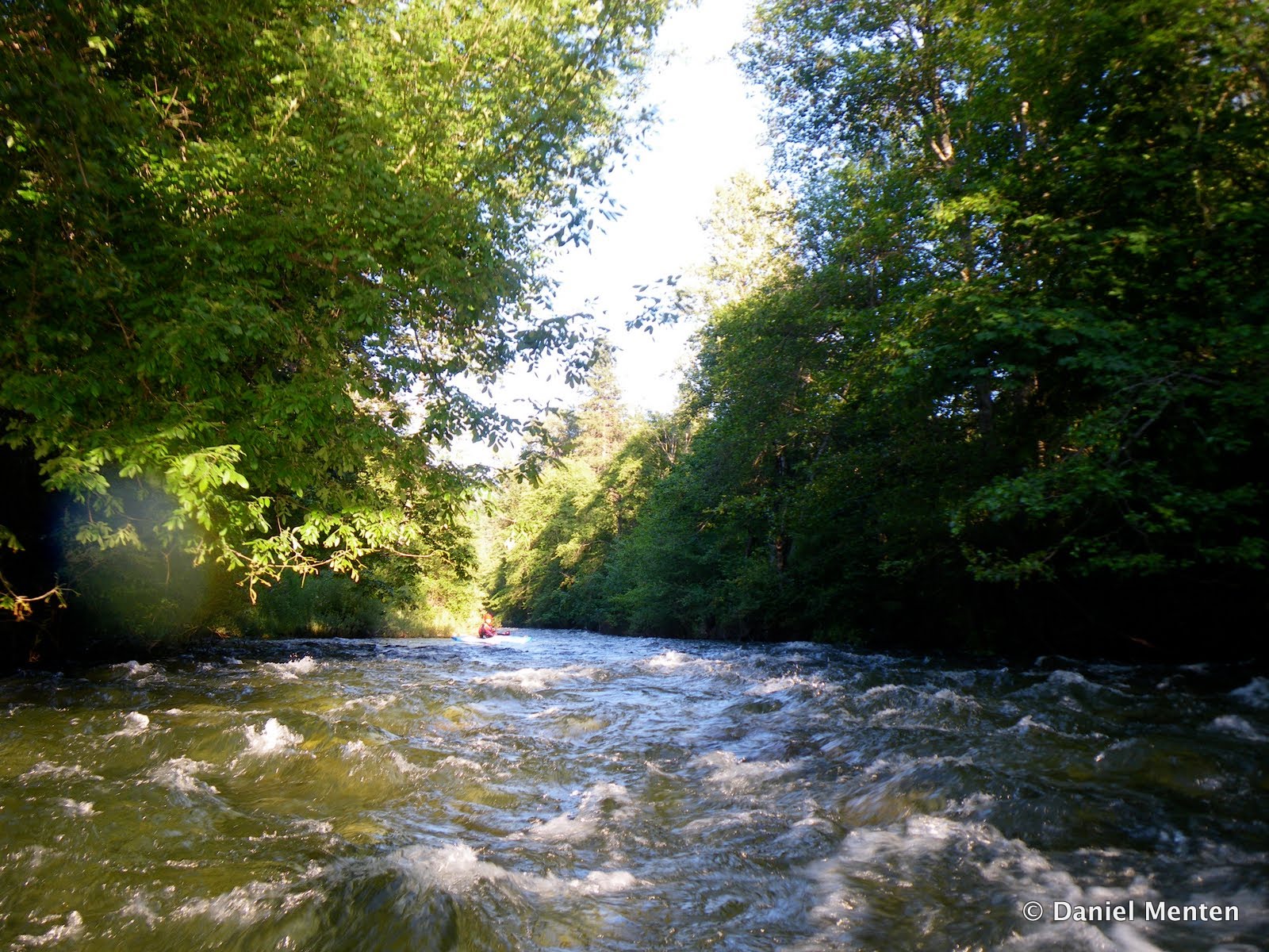
Once on the water, the pace was steep and continuous (200 fpm+). A little more water would be nice, making the big drops spicier though. Here is John Warner on Elk Cr. above the Granite Cr. Confluence

After 1.5 miles we reached the Dream Chute, where the creek drops through a steep boulder-garden/cascade into a gorged out waterfall with a sticky hole. I had seen pictures of this on Google Earth, and it was veritably responsible for us hiking all the way to Granite Creek. I decided to give er a go, and wound up plugging the hole, logging seconds of downtime and emerging with a huge back-ender into the hole. Somehow I managed to flush against the wall, rolling up with a big smile.
Here is John Warner scoping the Dream Chute.

Looking down into Dream Chute

More boulder gardens continued, with occasional bedrock goods spiced in too. The gradient was steep, yet despite the forest fire, we didn't have one log portage. Here is Miguel in Chopstick Rock.

Miguel sliding down Upper Elk Cr.

We finally arrived at Smooth Walls Falls, where a diversity of lines treated us O.K.

Below here more steep rapids continued all the way to Sulphur Springs, where we took our lunch break. It was here that the creek changes character, from a IV(V) to a III-IV section. Because it was such a long drive, our shuttle was set at the Klamath confluence, 13 miles downstream. Here is Miguel sticking a boof in his new Burn.

A quiet moment on Elk Creek

Many more miles of mellow water brought us to the final 5 miles, containing an interesting class IV bedrock section and the one rapid we all portaged. Here is Miguel charging the corkscrew drop.

Here is the rapid we portaged. It would've gone, probably on both sides, but it was the end of a long day for us, when we reached take-out we'd paddled almost 16 miles, dropping close to 2,000 feet of gradient.

Finally...the take-out!
The Confluence.

Wish I could post a picture of my cataraft sailing down the portage piloted by Mark Fritzke...quite a sight. I would love to raft this run again. Not too high of water though. )
ReplyDeleteDr. Strange